KLOSTERMAN BAYOU WATERSHED MASTERPLAN
Focusing on Sea Level Rise
and Climate Change
This study primarily focused on water quality, flood control and natural systems improvement projects. The Water Management Plan considered future scenarios by incorporating sea level rise (SLR) and climate change as it relates to rainfall patterns (changes in depth, duration, intensity) as part of the County’s resiliency planning efforts. This WMP will be used as a tool in the planning, regulation, and management of watersheds for future development and for determining and prioritizing capital improvement projects.
LOCATION: Klosterman Bayou watershed, Florida
AREA: Northwest Region of Pinellas County
DATE: June 2023
SIZE: ~2000 Acres
CLIENT: Pinellas County
ROLE: Watershed Management
COLLABORATORS: SWFWMD, City of Tarpon Springs
FEATURES: Floodplain Analysis, Flood Protection Level of Service Determination, Surface Water Resource Assessment, BMP Alternatives Analysis
Klosterman Bayou abuts 6 other watersheds. Lake Tarpon to the east, Sutherland Bayou and Smith Bayou towards the south, Anclote River and St. Joseph Sound to the north and Clearwater Harbor to the west. All boundary conditions from the abutting watersheds were considered during the development of the WMP. Anclote River and Smith Bayou have been evaluated and modeled and a Watershed Management Plan for Lake Tarpon is currently in progress.
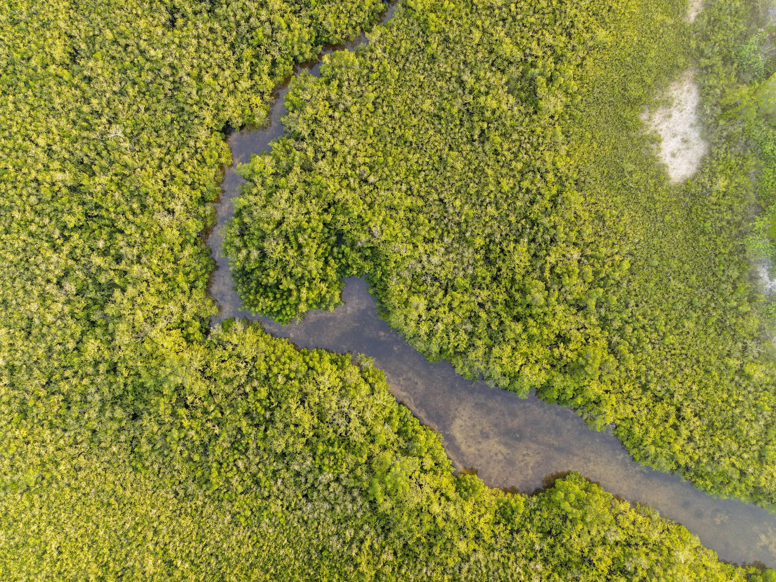
Klosterman Bayou is a lagoonal embayment and has headlands both to the north (Klosterman Point) and south (Danenman Point) of it. The western end of Klosterman Bayou connects to the St. Joseph Sound which is within the Pinellas County Aquatic Preserve. Approximately one-third of the Klosterman Bayou watershed is tidally influenced (estuarine/marine), and approximately two-thirds of it are uplands (freshwater).
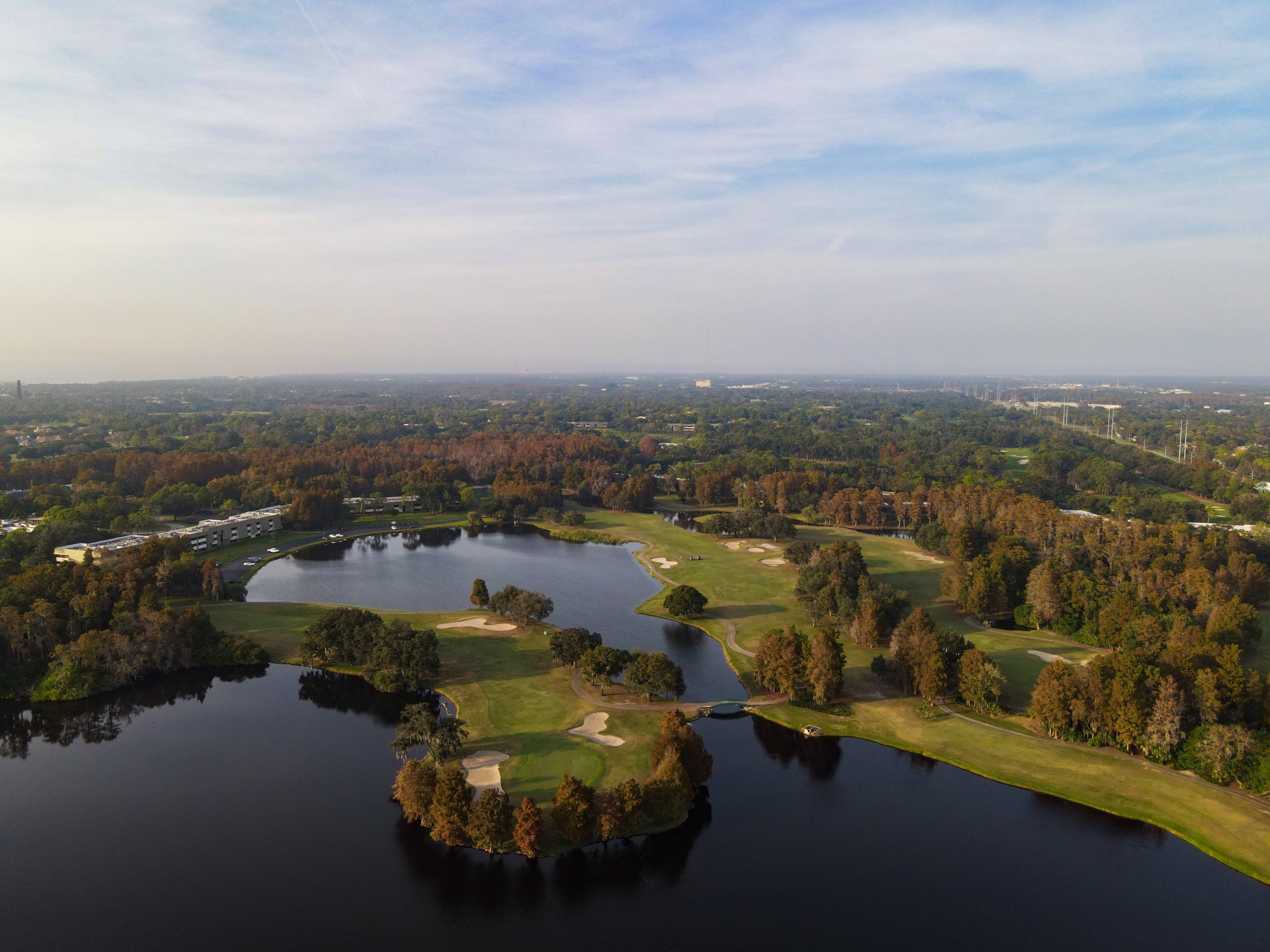
The watershed includes a combination of commercial, industrial, open land, golf courses/recreational, residential, transportation, upland forest, water, and wetland land uses. There are 2 major tributaries in the watershed - Channel A and Channel B. Channel A is the main tributary draining Innisbrook Golf Course, which occupies a substantial amount of the watershed. The primary drainage pattern for the Klosterman Bayou watershed generally occurs from southeast to northwest – stormwater runoff crosses north from south of Bee Pond Road into the lake system/central canal within the Innisbrook Golf Resort and across Alternate U-19 into the tidally influenced man-made finger canals which route to Klosterman Bayou. The Innisbrook Golf Resort has a backflow prevention system on its west side to prevent migration of brackish water into its interconnected lake system.