NORTH CITRUS COUNTY WATERSHED MASTERPLAN
Floodplain Analysis
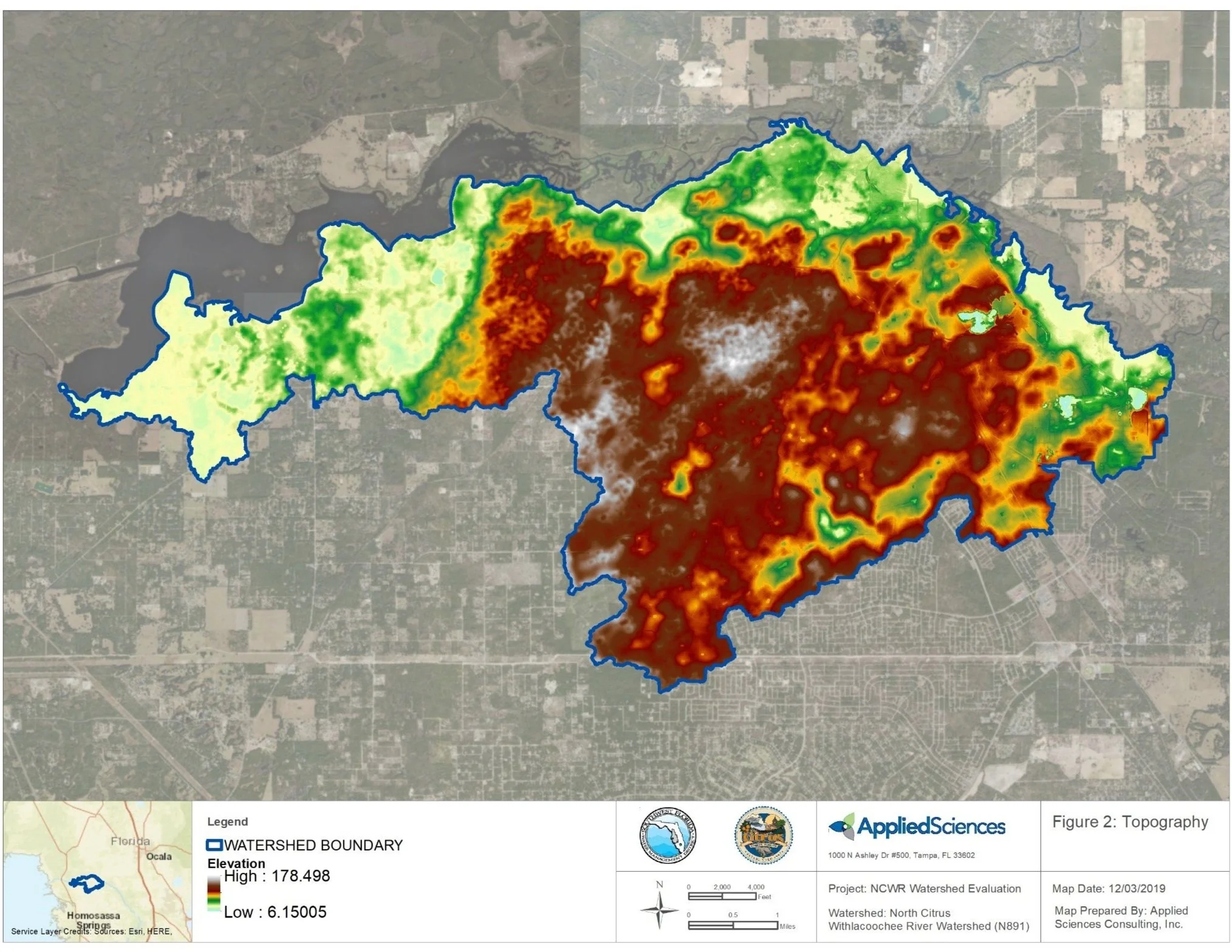
Applied Sciences was selected by the Southwest Florida Water Management District (District) to complete a Watershed Management Plan (WMP) including floodplain analysis, Stormwater Level of Service analysis (LOS), Surface Water Resource Assessment (SWRA), and Best Management Practice (BMP) alternative for the North Citrus Withlacoochee River Watershed in Citrus County. The watershed is approximately 40 square miles and is located adjacent to Lake Rousseau, upstream of the Inglis dam.
The Withlacoochee River Profile and North Citrus Boundary Conditions are generated utilizing the Atkins Model, FEMA Studies, and USGS/District gauging station Data. An analysis of the Atkins Model output results will be used to establish the various return interval boundary conditions (profiles) for the Withlacoochee River. All work will be completed in accordance with District’s Watershed Management Program Guidelines and Specifications (WMP G&S).
Following model development, Applied Sciences will map the Floodplain for a range of storms, including 100-year storm. Additional tasks include completing a Flood Protection Level of Service (FPLOS) Model Development throughout the watershed for roadways and structures, preparing a SWRA throughout the watershed for water quality improvements, and conducting a BMP Alternative Analysis within that portion of the watershed located beyond the Withlacoochee River Floodplain.
LOCATION: Citrus County, Florida
AREA: North Citrus Withlacoochee Watershed
DATE: On-going
SIZE: 40 Square Miles
CLIENT: SWFWMD
ROLE: GIS Analysis, Modeling, Civil Engineering, Water Resources Planning
FEATURES: GIS Analysis, Water Management, Flood Risk Assessment